Hektar was developed with a single goal; helping you create better projects.

To help you set the framework for truly great city planning, we developed Hektar – a tool for early-stage volume studies. Helping you deal with the inherent complexity of this critical design phase, generating proposals that synthesize the intelligence of code with the artistic touch of a human.
A site does not live in isolation. Its context may be the single most important aspect influencing the design of new or additional urban fabric.
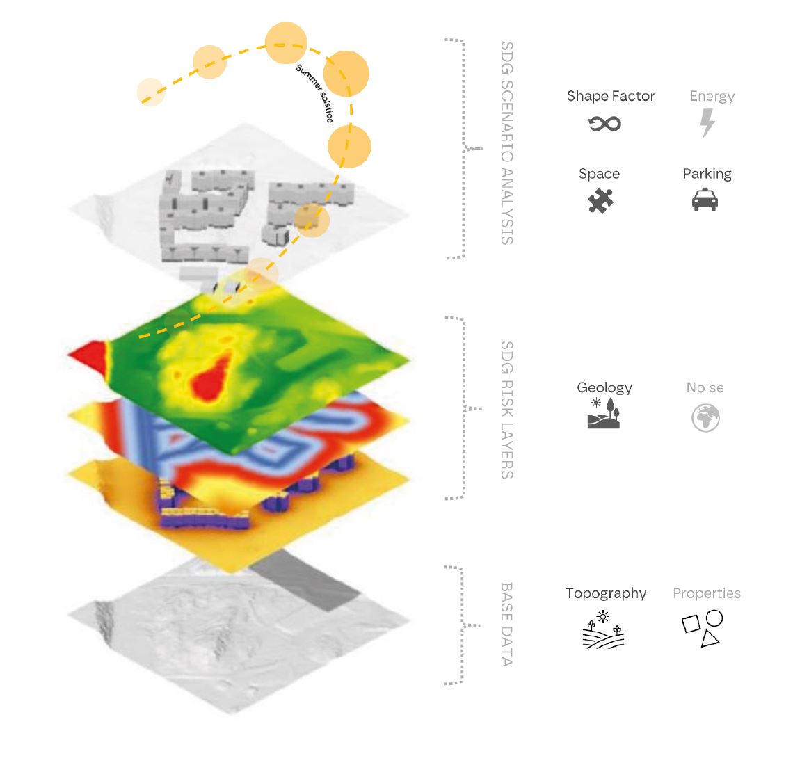
We developed a toolset to provide geometrical and geographical awareness to the generative algorithm, pinpointing crucial aspects of planning. Points of access to the site, non-buildable zones and user-defined streets just to mention a few.
A set of numerical inputs provides further control and resolution to your project. What is the depth of a building? How much greenery? How much parking? Go ahead and tweak the inputs to see how it affects the scenarios, or let the algorithm decide what it thinks will work best, and just explore the results!
The core of Hektar is using evolutionary algorithms and artificial generative intelligence to create feasible concepts and well-grounded estimates. It methodologically treats your inputs from a rough framework to more nuanced detailing, saving all metadata for you to evaluate as it progresses to a design proposal.
Consider it an autopilot of sorts, here to seamlessly complement you. It will keep the plane flying smoothly and safely through the monotonous bits and complex turbulences for the pilot to be refreshed and alert during start and landing. Similarly, Hektar is nothing but augmented architecture. For you, this means less time wasted guessing and more qualitative time designing.
Hektar has been developed to cover a wide range of proposals within the constraints. In part, this ensures that we include scenarios one might have missed, merely due to limitations as to how many options we as humans could possibly conceive.
Additionally, Hektar will process complex information such as light and sun from the very start of the geometry pipeline, producing proposals that far exceed human capabilities. Combined with a feature to filter out case studies according to various parameters you will easily find the most interesting to you.
Through Mapbox and Open Street Map Hektar has world-wide access to map data.

See components of the urban fabric more clearly with detailed layers of information.

Metadata has been preserved throughout the geometry pipeline.

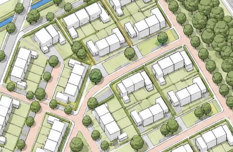
See your scenarios from different points of view.

Download your proposals as .obj, .3dm, and .csv.

Simply specify what typologies exist in your project and to what extent. Then specify the characteristic of each typology. Whether a dense urban master plan or a suburban single-family housing project, Hektar has got you covered!
May 13, 2026
May 13, 2026

April 10, 2025


