
Articles
Urban Development
May 13, 2026

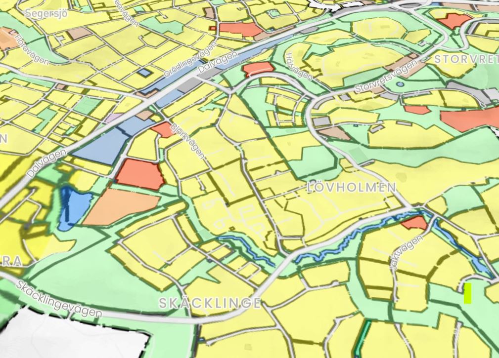

In 2020 we presented a generative design workflow with Bonava at Autodesk University. The 2020 work treated the site as a defined input. The buildable envelope, the regulatory constraints, and the topography were given. The interesting work was placing standardized houses inside that envelope.
A year later, in 2021, we ran a follow-up project under the Swedish Smart Built Environment programme, again with Bonava as a partner. The premise was different this time. What if the site itself was not a defined input but a structured combination of geodata layers, sourced directly from Lantmäteriet? What if generative design could start one step earlier, from the public data that describes Sweden as a whole, rather than from a manually prepared site model?
Five years later, this question turns out to have been the right one. The pattern we explored in 2021 has become the foundation for how Hektar actually works today. This post is a retrospective on what we built then and what it has meant for the product since.
Lantmäteriet is the Swedish national mapping authority. They publish a wide range of geodata in structured form: cadastral boundaries, elevation models, building footprints, infrastructure networks, hydrographic data, and protected area designations. Most of this data is available openly or through institutional access agreements. For a generative design tool, it is the closest thing Sweden has to a national constraint layer.
The Smart Built project asked a specific question. If we treat Lantmäteriet's geodata as the input to a generative design workflow, can we evaluate sites at scale without manually preparing each one? Can we point the tool at a piece of Sweden and have it understand the site context automatically?
This was not a trivial question in 2021. Most generative design at the time still depended on hand-prepared site models. The site was treated as a clean container that the algorithm operated inside. Bringing real geodata into the loop meant dealing with the messiness of public data: gaps in coverage, inconsistencies between datasets, varying resolution, and the gap between what the data says and what is actually true on the ground.
The prototype combined three data flows.
From Lantmäteriet: parcel boundaries, elevation models, building footprints of existing structures, and infrastructure networks for roads and utilities. This formed the geometric and topographic basis of any site the tool was pointed at.
From Bonava: the catalogue of standardized housing typologies that had been the foundation of the 2020 work. Fully modeled Revit families with associated cost, structure, and dimensional metadata.
From the generative engine: the algorithmic logic for placing typologies on a site, respecting setbacks, road access, orientation preferences, and basic regulatory constraints. This was the same generative loop refined from the 2020 work, now consuming richer site data.
The output was a feasibility assessment that could be produced for any parcel in Sweden, given access to the underlying geodata, without the manual setup step that had previously dominated early-stage work. A business developer could nominate a site, and the system would return a structured evaluation of what the Bonava catalogue could deliver on that specific piece of land.
The prototype worked, but it had limits that are worth being clear about.
The geodata layer was strong on geometry and weak on regulation. Lantmäteriet provides excellent physical and cadastral data. The regulatory layer, the actual content of detaljplaner, was not yet machine-readable at the scale we needed. Zoning information had to be manually entered or approximated. This meant the system could tell you about a site's shape, topography, and physical context, but it could not yet tell you what the detaljplan would allow on that site.
The generative engine was still optimizer-first. The 2021 work used the same kind of multi-objective optimization that we had used in 2020. The output was a Pareto front of layouts, ranked on weighted criteria. The transparency problem that we had identified the year before was not yet solved. Why a specific layout existed was often hard to articulate beyond "the optimizer chose it."
The system was not interactive. Generation ran in batch. A user nominated a site, waited, and reviewed results. The fast iterative exploration that defines modern feasibility tools was not yet feasible at the data volumes we were working with.
None of these were failures of the project. They were the actual state of the field in 2021. Identifying them clearly was part of what the project produced.
Despite the limits, the Smart Built work established three principles that have shaped everything we have built since.
First, public geodata is the right starting point. A feasibility tool that depends on manual site preparation cannot scale. A tool that consumes structured public data can evaluate any site that data covers. This is the difference between a consulting tool and a product. Smart Built made it clear which direction Parametric needed to go.
Second, the integration cost is the real cost. Generating geometry is computationally cheap. Integrating geodata, typologies, regulatory information, and project requirements into a coherent feasibility surface is where the actual engineering effort lives. The Smart Built prototype was as much a data integration project as it was a generative design project, and that pattern has held for every product decision since.
Third, product thinking on both sides is what makes the loop work. Bonava had committed to a product catalogue. Lantmäteriet had committed to publishing structured geodata. The generative tool worked because both sides had done the upstream work that made it possible to query their data systematically. Without product thinking on the building side and data infrastructure on the site side, there is nothing for the algorithm to operate on. This pattern has shown up again in our Vienna work and the Heijmans collaboration in the Netherlands.
Looking back, the Smart Built project sits in the middle of a longer arc. The 2020 Autodesk University work established the generative loop with Bonava's product catalogue. The 2021 Smart Built work extended that loop to consume geodata at a national scale. The 2023 Vienna work pushed the idea further into modular construction. The Heijmans work showed the pattern repeating in the most digitized European market. The 2026 Vinnova project on detaljplan compliance is the next step, finally addressing the regulatory layer that Smart Built had to leave manual.
None of these projects was the answer on its own. Each one contributed a piece of a structural insight: that early-stage feasibility for raw land is fundamentally a data integration problem with a generative algorithm sitting on top. Get the data right, and the algorithm becomes useful. Get the data wrong, and no amount of algorithmic cleverness compensates.
Hektar today reads geodata from Lantmäteriet automatically for any Swedish site. The user does not prepare the site model. The site context loads as data, including parcel boundaries, terrain, existing buildings, and infrastructure. This was the capability that Smart Built piloted, and it is now standard product behaviour for Swedish projects.
The same pattern has been extended to other markets. The Netherlands integration follows the same logic with Dutch open data. Norwegian and Danish equivalents are progressing. The underlying principle that public geodata should drive the site side of the feasibility loop traces directly back to the Smart Built work in 2021.
Research projects often sit on a shelf and produce a report that nobody reads. The Smart Built project was different. The principles it established are running in production today, and the limits it identified became the agenda for the next five years of work. That is what cross-sector collaboration is supposed to do. Combine the public data infrastructure that a country has invested in, the product thinking that a developer like Bonava has invested in, and the algorithmic capability that a research team can contribute, into something that none of the three could have built alone.
The detaljplan compliance work we are now starting with the new Vinnova project is the natural continuation. The structural insight from Smart Built was that you cannot do early-stage feasibility well without integrated public data. The structural ambition of the new project is to extend that integration from physical geodata into the regulatory layer. Same logic. Bigger scope. Same partners' commitment to the long game.


