
Articles
Urban Development
May 26, 2026

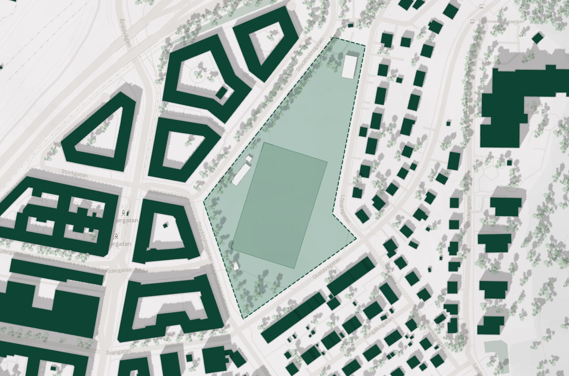

Most land acquisitions still begin with a site visit and a spreadsheet. A developer drives past a parcel, estimates its potential based on experience, and builds a case around a single concept. If the numbers look reasonable, the project moves forward. If they don't, the site gets shelved. Either way, the decision rests on intuition shaped by whatever the developer has built before.
This approach worked when land was abundant and margins were forgiving. In today's market, where viable sites are scarcer, zoning is more complex, and capital demands stronger justification, gut feel is an expensive way to evaluate raw land.
Experienced developers have strong instincts. They can look at a parcel and sense whether it will work for housing. But instinct compresses information in ways that are hard to audit. A developer might dismiss a site because it reminds them of a difficult project from five years ago, or pursue one because the geometry feels familiar. These pattern-matching shortcuts are useful, but they also introduce blind spots.
The deeper issue is that experience tends to anchor evaluation around a single typology or concept. A developer who has built mostly lamella rows will instinctively assess sites through that lens. A firm that specializes in perimeter blocks will see courtyard potential everywhere. This isn't a flaw in judgment. It's a natural consequence of working within a specific repertoire. But it means that sites with unconventional potential often get overlooked, and sites that seem promising get evaluated against only one possible configuration.
As risk compression in early-stage development becomes more critical, the cost of these blind spots grows.
Structured site evaluation starts with assembling the data that already exists but rarely gets combined in a single view. Topography, zoning regulations, noise levels, solar exposure, soil conditions, existing infrastructure, and surrounding context all shape what a site can deliver. Individually, each data point tells a partial story. Combined, they define a constraint envelope that is far more informative than a site visit alone.
Consider a 2.4-hectare parcel on the edge of a mid-sized Swedish municipality. A site visit suggests open, relatively flat land with good road access. Promising. But when you layer in road noise data, you discover that 30% of the site exceeds recommended levels for residential facades. Solar analysis reveals that a ridge to the south cuts direct sunlight to parts of the site during winter months. Zoning allows up to five stories, but the municipality's comprehensive plan signals a preference for three.
None of these facts are deal-breakers on their own. But together, they reshape the site's realistic capacity from an optimistic 280 units down to roughly 180 to 210, depending on typology. That's a 25-35% reduction in projected yield before a single sketch has been drawn. A developer who committed capital based on the initial estimate is now managing a gap that could have been identified in hours rather than months.
Data layers define what constraints exist. Generative massing defines what those constraints allow. This is where the evaluation shifts from descriptive to predictive.
Instead of asking "what could we build here?" in the abstract, generative feasibility tools answer that question concretely by placing buildings on the site within the defined constraints. Different building typologies (lamella rows, perimeter blocks, point towers, or hybrid configurations) are tested against the same constraint set, producing comparable outcomes across density, sunlight performance, open space, and construction volume.
This matters for acquisition because it replaces the single-concept evaluation with a range of validated scenarios. A site that looks marginal for perimeter blocks might perform well with a combination of lamella rows and point elements. A parcel that seems too constrained for 200 units might deliver 220 if the typology strategy shifts from four-story walk-ups to a mix of three and six stories.
The acquisition decision is no longer "does this site work for what we usually build?" It becomes "what is the best this site can deliver, and under which configuration?"
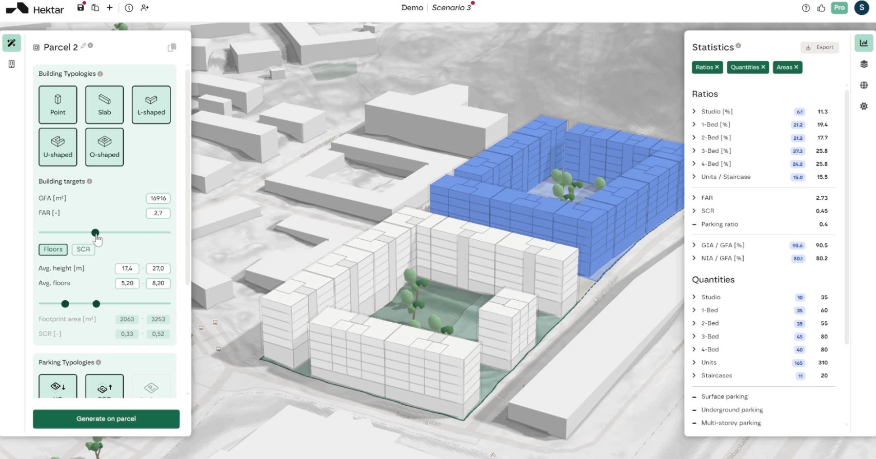
Traditional feasibility analysis is slow enough that developers can only evaluate a handful of sites at any given time. Each evaluation requires sketch studies, consultants, and weeks of iteration. This creates a natural bottleneck: teams spend significant unpaid effort on sites that may not proceed, and they pass on sites that don't immediately fit their mental model.
When structured evaluation can be completed in hours rather than weeks, the economics shift. A development team can assess ten or fifteen sites in the time it previously took to evaluate two. This changes acquisition strategy from reactive (responding to offerings) to systematic (scanning multiple parcels against defined criteria).
For property developers competing for the same land, speed and depth of evaluation become a real advantage. The firm that can present a municipality with three validated development scenarios within days, rather than a single concept sketch after three weeks, has a stronger position at the negotiating table.
A structured, data-driven acquisition workflow typically follows four steps.
First, constraint mapping. Assemble geodata, zoning parameters, noise levels, topography, and solar conditions into a unified site model. This is the foundation that every subsequent evaluation builds on. Tools like Hektar's site analysis features make this assembly systematic rather than ad hoc.
Second, scenario generation. Test multiple typology strategies against the constraint set. Vary building heights, coverage ratios, and unit mixes to understand the range of feasible outcomes. The goal is not to find the perfect solution but to define the solution space.
Third, comparative analysis. Evaluate scenarios against acquisition criteria: total GFA, unit count, expected construction cost drivers, daylight and outdoor quality metrics, and alignment with municipal preferences. Statistical analysis across scenarios reveals which variables matter most for the specific site.
Fourth, decision framing. Present the acquisition recommendation not as a single number but as a range with clear assumptions. "This site can deliver 180 to 220 units depending on typology strategy, with the higher range requiring a variance on height in the eastern parcel" is a fundamentally more useful input to an investment decision than "we think we can fit about 200 units."
The real estate industry's adoption of data-driven workflows has accelerated significantly. Over 72% of real estate firms now plan to increase their investment in AI and data analytics tools. The firms that are moving fastest are not necessarily the largest. Small, focused teams with access to structured evaluation tools can now match or exceed the analytical depth of much larger organizations.
What's changing is not just the technology but the expectation. Municipalities increasingly want to see evidence that density proposals are grounded in site-specific analysis, not generic assumptions. Investors want to understand the range of outcomes, not just the base case. And development teams want to spend their time on sites that will actually proceed, not on speculative sketches that lead nowhere.
The gap between gut-feel acquisition and data-driven evaluation will only widen. The developers who close it first will find better sites, make stronger cases, and commit capital with greater confidence.


